Thursday, August 27, 2009

The industrial wonders of northwest Indiana

Whiting. Hammond. East Chicago. Calumet City. Pullman. Harvey. Dixmoor. Blue Island. Gary. As I slowly become more familiar with the southern reaches of Chicagoland, these names gain more and more resonance for me. Each speaks of strange contrasts, lands of tidy lawns and raw industry, urban decay and pastoral emptiness. It's a land slightly mythologized by the movie Blues Brothers, whose grungy titular characters rarely ventured north of the Loop. It is a region that has worked hard and sacrificed much over the decades, the city's blue collar underbelly, the engine that drove Chicago to its industrial peak, only to be abandoned and neglected when US industry began collapsing.

I could gaze at this forever.

Despite the hard times, a lot of heavy industry remains here. The Port of Chicago operates here, receiving a steady trickle of Great Lakes freighters. And from Whiting, all the way into Michigan, a line of industrial sites makes Highway 912 one of the most amazing places on the planet.

The industrial sprawl once started much further north, within the Chicago city limits, at the site of the US Steel South Works, once the largest steel mill complex on the planet. That facility closed nearly two decades ago, and was leveled to the ground. With the subsequent demolition of the mills and factories along S. Torrence Avenue to the west, large-scale industry has mostly vanished from the Chicago City limits.

Despite the decline, even the most cursory overview of the industrial regions is a big undertaking. The action today, then, begins at the Chicago Skyway bridges, which soar to incredible heights to cross the Grand Calumet River.
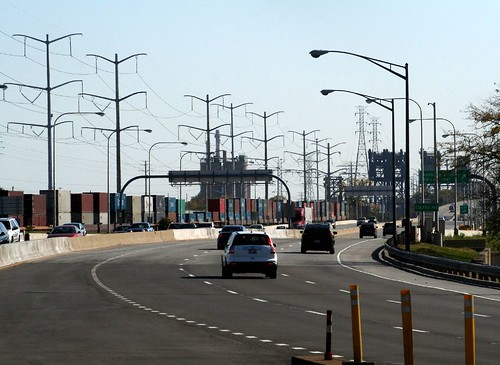
That endless skyway

Below the skyway bridges, a profusion of industrial sites loads ships and barges, as tugs and speedboats drift past. A trio of movable railroad bridges stands abandoned, their tracks long since torn up, too big and cumbersome to demolish.
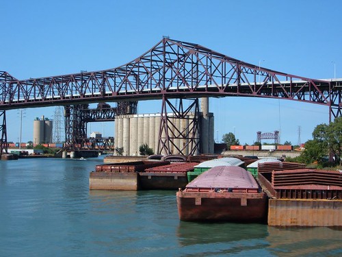
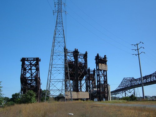
The Chicago Skyway

Gunfighters...

After the Skyway bridges, one passes the looming State Line Generating Station, which sits just yards away from the Indiana/Illinois border.
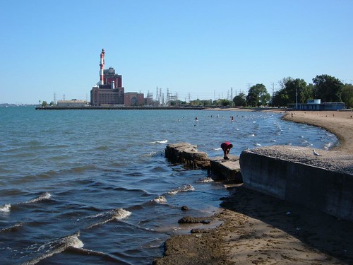
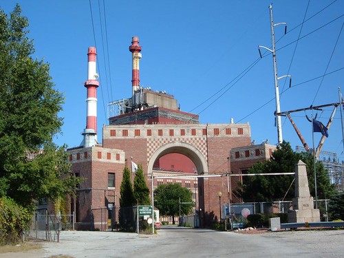
State Line Generating Station

State Line Generating Station

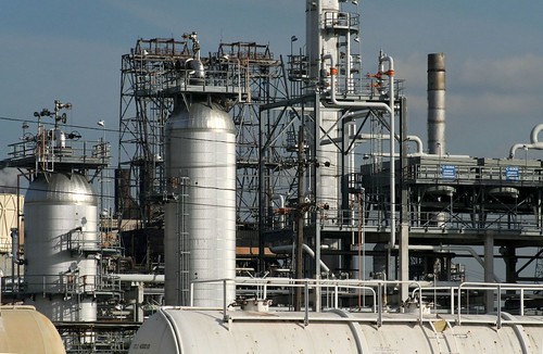
Rolling on southward, you'll pass a profusion of casinos, gas stations, medium industrial sites (including the sometimes overpowering smell of Lever soap being manufactured). This land is essentially one continuous urban development, but the "town" of Whiting is one of several here that has its own distinct main street and central business district. Whiting also abuts an enormous refining complex owned by British Petroleum.
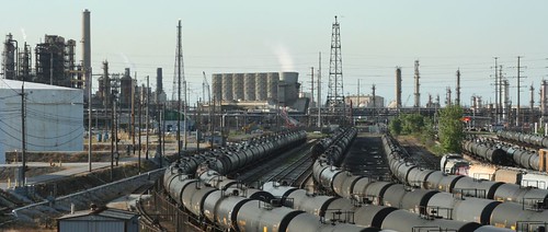
Tank car army

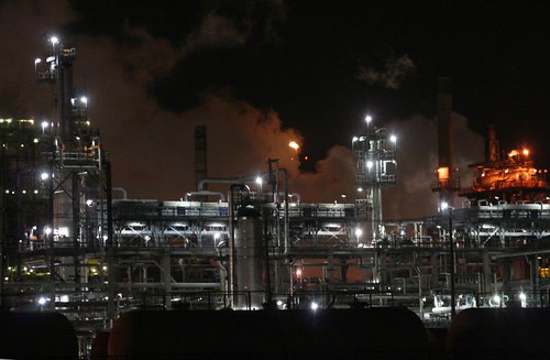
BP Refinery at Whiting

Bladerunner

The BP plant sprawls all the way up to the first of the steel mills, the huge facility of Ispat Inland Steel, built on a peninsula made of landfill. Crushed between the two complexes is the tiny planned workers' village of Marktown, one of the most incredibly isolated residential neighborhoods you're ever likely to find, and well worth a post of its own.
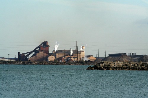
Inland Steel

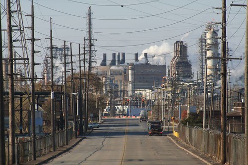
Awesome industrial hell

If there's a center to all this insanity, it's the Indiana Harbor and Ship Canal, which runs right through the center of the Ispat Inland complex, and is crossed by a dizzying array of bridges and overpasses.
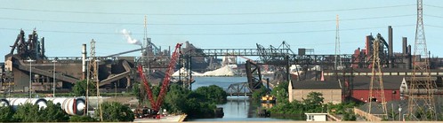
Indiana Harbor and Ship Canal

Highway 912, aka Cline Avenue, provides an elevated view of the Inland Ispat complex, bringing you nose-to-nose with some of their gargantuan buildings and flying high above their grounds.
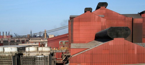
Inland Steel

Cline Avenue turns away from the lake as it continues south, but the industrial sprawl continues. As soon as Ispat Inland's reign ends, US Steel begins. US Steel is the reason Gary exists; they constructed the city as their own company town. Their mini-empire runs for miles along the lake, and consumes the vast majority of Gary's lakefront.

US Steel's Gary Works is frustratingly inaccessible. Multiple entry points are steadfastly guarded against such wayward rouges as photographers, explorers, and curiosity seekers.
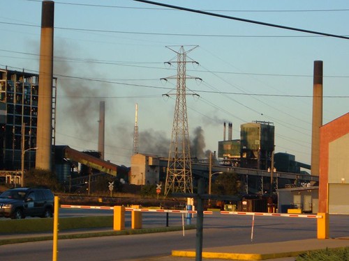
I think there was a fire.

Once you finally get past US Steel, the lakeshore of Gary is quite lovely, marking the beginning of the Indiana Dunes lakeshore park. Due to some Machiavellian bargaining back in the 1950s, part of the dunes was carved away to provide room for still more industry, another steel mill (likewise inaccessible) and a power plant at Michigan City that looms over some of the beaches.

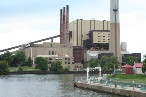
Indiana Dunes

Michigan City power plant

It can be a shock to look back from east Gary's waterfront and suddenly realize how far you've come from Chicago, whose skyline is 30 miles distant and barely visible across the lake. And it's a bigger shock to realize the amount of industry you've passed along the way.
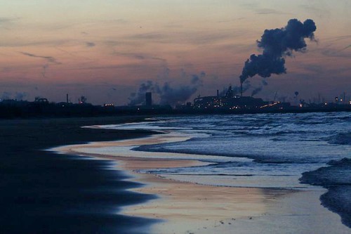
I expect prize money for this shot.

Tuesday, August 25, 2009

Reese and Gropius - tomorrow at CAF

"Gropius in Chicago: A Legacy on the Brink"

Come down to the Chicago Architecture Foundation tomorrow (Wednesday, August 26 at noon, free) for a lecture on the role that Walter Gropius had in shaping Chicago's endangered Michael Reese Hospital complex. Grahm Balkany of the Gropius in Chicago Coalition presents.

Separated at birth?

Ugly on the whole, yet made of awesome pieces.

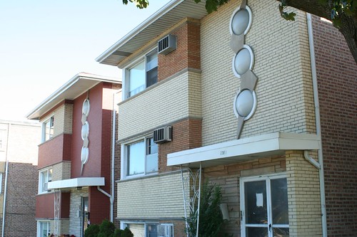
Compare this breezeway apartment building on 95th Street with this trio of 3-flats on 79th Street.

79th Street lightning bolt

3-flats, 79th Street

They have nearly the same decorative elements, just used differently!

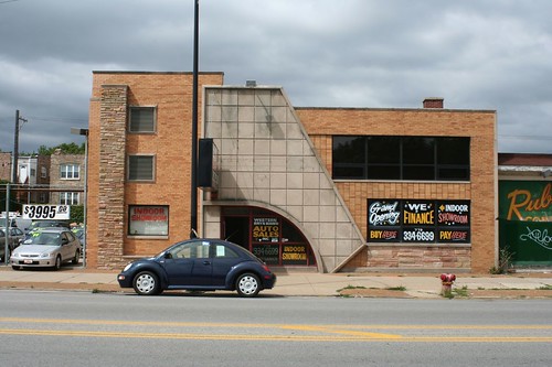
Meanwhile, here's a distant cousin, up north on Western Avenue:

Auto sales store, Western Avenue

If you're like me, you've passed by it many times without being able to stop and appreciate its lovely geometry. The angled concrete panels work to conceal a joint in the building, where it changes roof heights. The curved entry and the angled edges both dive playfully into the ground.
Friday, August 7, 2009

LATE Ride 2009

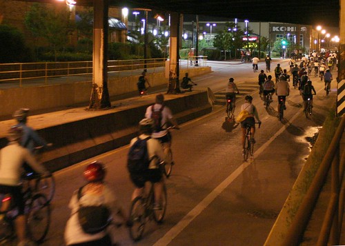
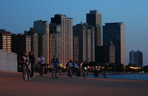
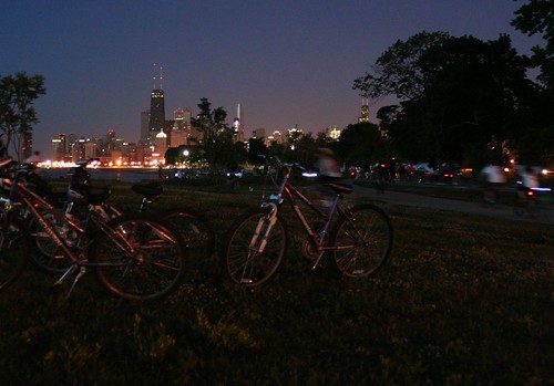
Scenes from the 2009 Chicago L.A.T.E. Ride:

Underpass

Waiting for the red to change

That's a DUCK, man, that's a DUCK!

The big curve

After crossing the marina bridge

Taking a break

Many more at my Flickr account.

Tuesday, August 4, 2009

Be warned... this link may make you sick

SASAKI AND COLLINS PARKS AND LANDSCAPES DESTROYED

The City of Chicago has destroyed countless trees, shrubs, and landscapes within the Michael Reese complex. The pictures are stunning. The City should be ashamed.

Thursday, July 30, 2009

Reader roundup

Some great articles in last week's and this week's Reader.

Regarding Michael Reese Hospital and the Olympics:
* Michael Reese Hospital: The First Sacrificial Lamb


Regarding the 100th anniversary of Daniel Burnham's Plan of Chicago:
* An Odd Way to Honor Burnham - Lynn Becker takes on the process by which the centennial pavilion architects were selected (and, incidentally, slaps down some gibberish from Colin Rowe and his followers about how "there was no Chicago School of architecture".)

* The Big Aluminum Hot Potato - will the centennial pavilions ever actually be finished?

* Go Ahead, Make Little Plans - a challenge to the Last Four Miles proposal (a plan which, by the by, I support wholeheartedly. It's ridiculous that one can't bike to Rogers Park via the lakefront.)

Friday, June 26, 2009

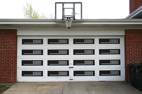
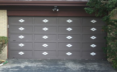
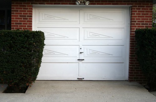
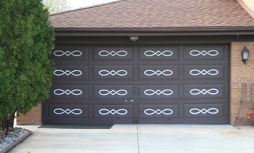
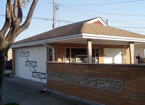
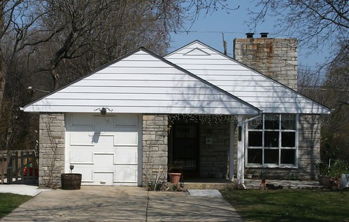
MidCentury Suburbs Part 7: Modernize your garage door!

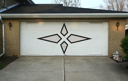
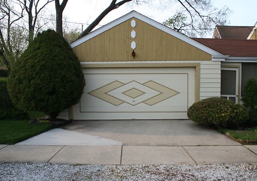
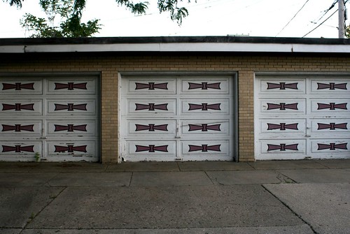
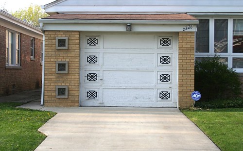
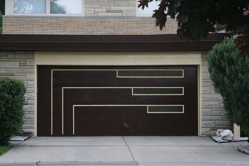
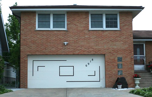
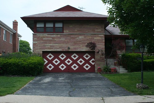
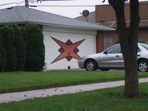
The garage door was yet another point of elaborate decoration for the MidCentury home. It provided a broad canvas for designers to decorate; in the 1950s and 1960s, the automobile was newly risen to its place of supreme importance, and its home was something to be celebrated -- as was the design innovation of the attached garage, a new luxury for most home buyers at the time.

Raynor Door, based not far from Chicago in Dixon, IL, was a major vendor of both doors and the patterns for them.

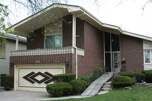
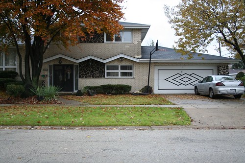
Two patterns were particularly prevalent, and can still be found by the dozens today:

IMG_1979a

IMG_1931a

Midcentury garage door

Midcentury garage door


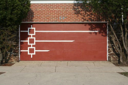
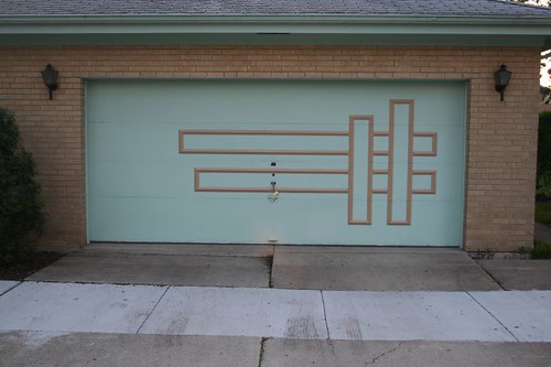
But the designs ranged all over the place. Asymetrical patterns were common:

IMG_1906

IMG_2025

Another common theme involved a series of small, repeating patterns instead of one big one:
IMG_1925

IMG_1924a

IMG_2032a

Such small patterns were often another reflection of the Old West influence on Chicago's MidCentury suburbia, as seen in this rope-like pattern:

IMG_1921a

Midcentury garage door

Small patterns didn't have to cover the whole door; they could form a border pattern instead:

IMG_1903a

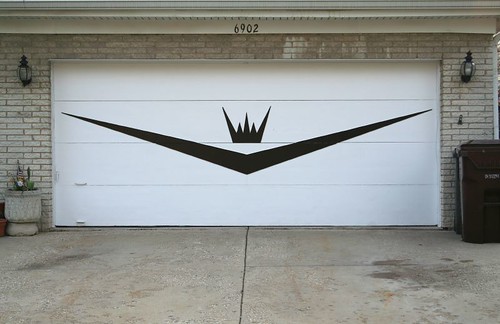
In the age of Kennedy's Camelot and the attendant New Formalism, you too can be a king!
IMG_1973a

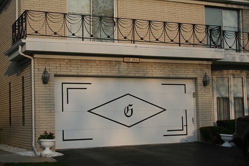
With your very own caligraphy-styled monogram!
IMG_1970

Or you can just be stunningly modern, classy, and geometrically smooth.
Midcentury garage door

Midcentury garage door


Or exuberantly modern...
Midcentury garage door

You can shout your modernity to the world!
Midcentury garage door

Midcentury garage door

Or you can quietly wait for the world to notice it.
Midcentury garage door

There is no end to the patterns. Still more may be seen at my Flickr account.

Thursday, June 25, 2009

Quarry town

Thorton Quarry

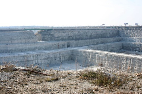
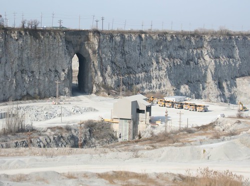
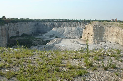
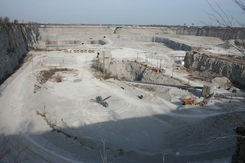
The fascination of a rock quarry isn't hard to grasp. Here in the unendingly flat Midwest, a quarry is a shocking interruption of the landscape. The walls are vertical cliffs, their relief impressive in their own right and doubly so in the middle of so much prairie land.

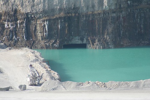
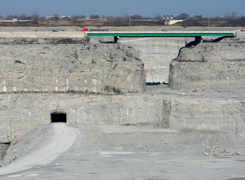
The artificial depths seem ominously unstable; despite the solid beds of rock that line their walls, it is hard to behold a quarry without feeling that somehow, Nature will strike back, bring the walls crumbling down, reclaim the pit, fill the vacuum. Land dikes separating quarry pits look precarious to begin with, even before they are pierced by Gothic arch-shaped openings to permit communication between pits. And water inevitably finds its way in, requiring constant pumping. The thought of water overwhelming the works of man is, I suspect, a primal fear on some level. Here it's not just a shadowy thought, but frank reality.

Thorton Quarry

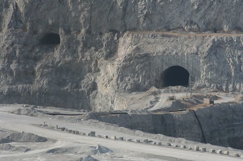
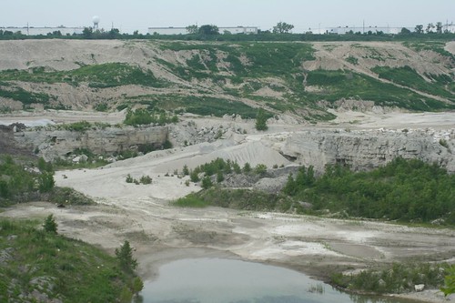
The quarry pit is a window into the Earth, showing us a slice of what lies buried under our feet. Rock strata that have not seen daylight in millions of years lay exposed to the world. Tunnels hint at darker depths still. The invasion of water gives one a visual grasp of the water table, the rivers moving below the earth's surface.

Thorton Quarry

And finally, the sheer volume of material removed to create these pits beggars imagination.

Thorton Quary

All this effort goes to remove minerals and rocks from the earth. A city the size of Chicago uses a lot of rocks. They doesn't just go into those MidCentury buildings I'm so fond of; they're cut and crushed and used as aggregate for concrete, gravel ballast for railroads, rip-rap for the lakefront, and many other purposes.

Being really heavy, rock is best harvested locally, and to that end there's a surprising number of quarries to be found around Chicagoland.

Thorton Quarry
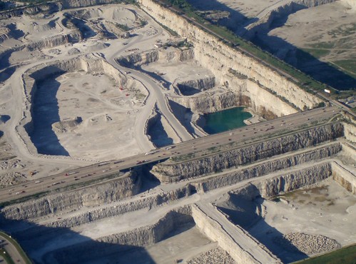
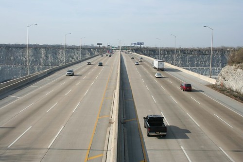
Thorton (the subject of all the above photographs) is the biggest and by far the most famous of Chicago's rock quarries. The reason is obvious: not only is it huge, but it's spanned by a massive and busy highway atop a two-hundred-foot high land dike.
Thorton Quarry

Tri-State Tollway

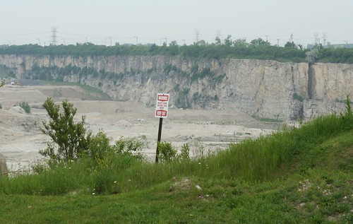
Views of Thornton Quarry are also easy to come by from the surrounding public roads. Access is limited by fencing, of course, but through the links one can see deep into the quarry's depths.

Thornton Quarry

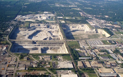
Thorton consists of four main pits, collectively forming one of the largest quarries in the world. Three of them are readily visible from the various roads hemming the site in. The material removed from here is for aggregates -- the little bits of solid stuff that goes into concrete and various other materials.

Thornton Quarry

The northernmost pit, shown here, is being converted to a stormwater holding facility, for when strong storms overwhelm the city's deep tunnel storage system.

Thorton Quarry

Tours of the facility are offered twice a year, and they fill up months in advance.

* Birds eye view at bing.com
* Thorton Quarry at Wikipedia


McCook Quarry
One of several pits operated in Chicagoland by Vulcan Materials Company, this pit operates beyond the city's upper southwestern limits, covering some 650 acres. Sadly, very little of its depths are visible from public roads.

Lemme tell you man, I've been everywhere!

Joliet Road, abandoned

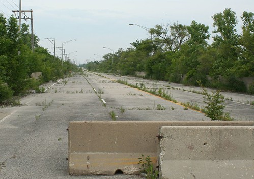
Speaking of pubic roads, McCook's operations have apparently destabilized one. Joliet Road crosses the quarry on a land dike, similar to the Tri-State's route across Thornton. But the road has been closed since the 1990s, fenced, barricaded and overgrown with weeds.

McCook Quarry

* McCook Quarry official web site


McCook is one of a string of quarries in the area; two more are directly northeast of it:

Reliable Materials Lyons Quarry
Somehow I missed this one on the ground, despite being only a mile away and on a very specific mission to visit quarries. I'll get it some day!

* Reliable Materials Lyons Quarry aerial view


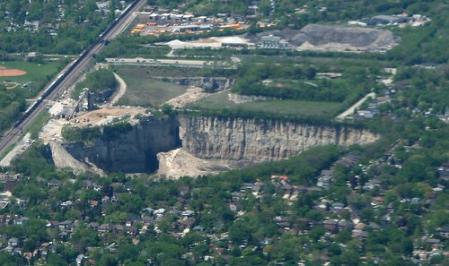
Unknown quarry, La Grange
Seen 'em haul rocks on the south side

Like McCook, very little of this one is visible from public roads. This is about the best view one can get from outside the property, and you'd better be prepared to hoist your camera up high.

* Aerial view


A skim through Vulcan's list of Illinois facilities turns up quite a few additonal quarries in and around Chicagoland, and a Google search shows even more. Most are either much smaller operations, or else are far out in the countryside, away from the developed lands that help make Thorton so remarkable. A couple of the more notable and nearby ones are:

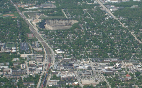
Elmhurst Chicago Stone Quarry

Elmhurst quarry

This former quarry now functions as a storm runoff holding facility for DuPage County.

Elmhurst quarry

I've seen it from an airplane, but I have yet to visit on the ground.

* Aerial view, showing the quarry flooded
* Elmhurst Quarry Flood Control Facility, with live images!


* Bolingbrook Quarry - aerial view
* Official site

* Laraway Quarry, Joliet - aerial view
* Offical site

* Romeo Stone Quarry - aerial view