Whiting. Hammond. East Chicago. Calumet City. Pullman. Harvey. Dixmoor. Blue Island. Gary. As I slowly become more familiar with the southern reaches of Chicagoland, these names gain more and more resonance for me. Each speaks of strange contrasts, lands of tidy lawns and raw industry, urban decay and pastoral emptiness. It's a land slightly mythologized by the movie
Blues Brothers, whose grungy titular characters rarely ventured north of the Loop. It is a region that has worked hard and sacrificed much over the decades, the city's blue collar underbelly, the engine that drove Chicago to its industrial peak, only to be abandoned and neglected when US industry began collapsing.

Despite the hard times, a lot of heavy industry remains here. The Port of Chicago operates here, receiving a steady trickle of Great Lakes freighters. And from Whiting, all the way into Michigan, a line of industrial sites makes Highway 912 one of the most amazing places on the planet.
The industrial sprawl once started much further north, within the Chicago city limits, at the site of the US Steel South Works, once the largest steel mill complex on the planet. That facility closed nearly two decades ago, and was leveled to the ground. With the subsequent demolition of the mills and factories along S. Torrence Avenue to the west, large-scale industry has mostly vanished from the Chicago City limits.
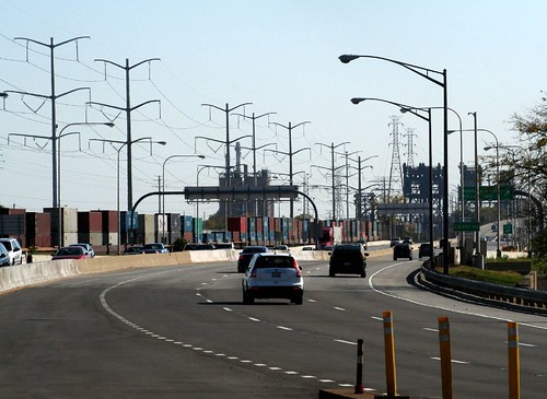
Despite the decline, even the most cursory overview of the industrial regions is a big undertaking. The action today, then, begins at the Chicago Skyway bridges, which soar to incredible heights to cross the Grand Calumet River.
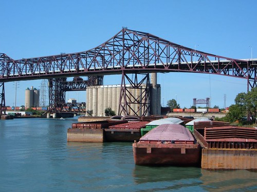
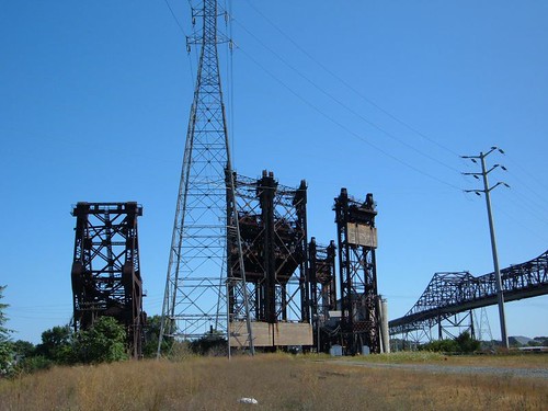
Below the skyway bridges, a profusion of industrial sites loads ships and barges, as tugs and speedboats drift past. A trio of movable railroad bridges stands abandoned, their tracks long since torn up, too big and cumbersome to demolish.
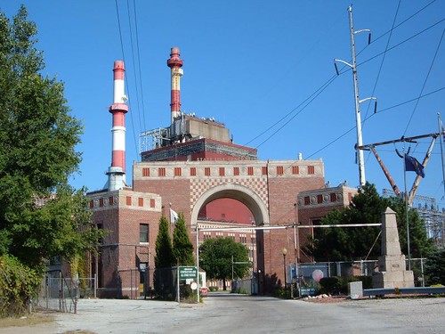
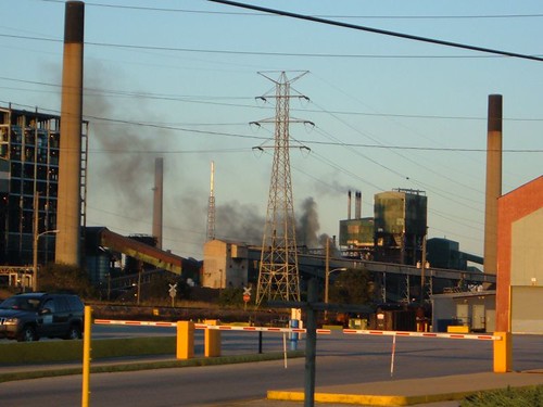
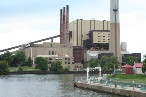
After the Skyway bridges, one passes the looming State Line Generating Station, which sits just yards away from the Indiana/Illinois border.
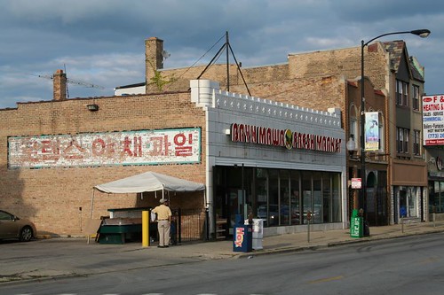
Rolling on southward, you'll pass a profusion of casinos, gas stations, medium industrial sites (including the sometimes overpowering smell of Lever soap being manufactured). This land is essentially one continuous urban development, but the "town" of Whiting is one of several here that has its own distinct main street and central business district. Whiting also abuts an enormous refining complex owned by British Petroleum.
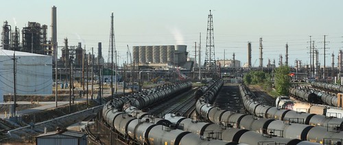
The BP plant sprawls all the way up to the first of the steel mills, the huge facility of Ispat Inland Steel, built on a peninsula made of landfill. Crushed between the two complexes is the tiny planned workers' village of Marktown, one of the most incredibly isolated residential neighborhoods you're ever likely to find, and well worth a post of its own.
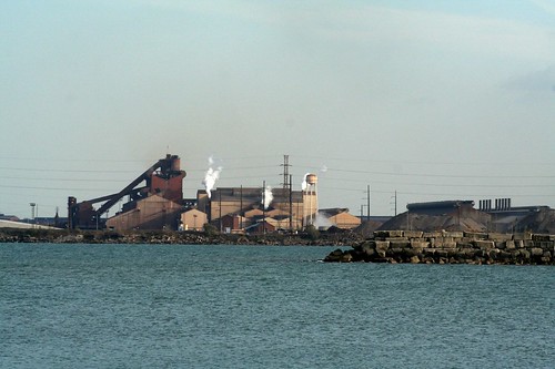
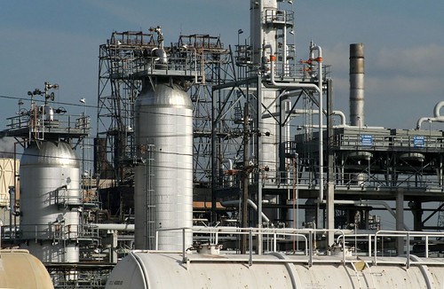
If there's a center to all this insanity, it's the Indiana Harbor and Ship Canal, which runs right through the center of the Ispat Inland complex, and is crossed by a dizzying array of bridges and overpasses.
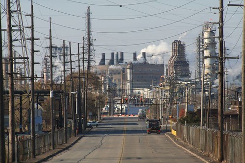
Highway 912, aka Cline Avenue, provides an elevated view of the Inland Ispat complex, bringing you nose-to-nose with some of their gargantuan buildings and flying high above their grounds.
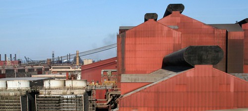
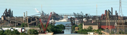
Cline Avenue turns away from the lake as it continues south, but the industrial sprawl continues. As soon as Ispat Inland's reign ends, US Steel begins. US Steel is the reason Gary exists; they constructed the city as their own company town. Their mini-empire runs for miles along the lake, and consumes the vast majority of Gary's lakefront.
US Steel's Gary Works is frustratingly inaccessible. Multiple entry points are steadfastly guarded against such wayward rouges as photographers, explorers, and curiosity seekers.
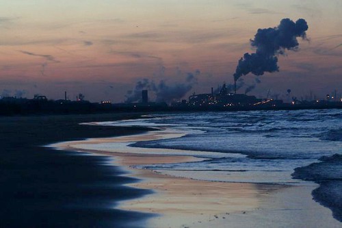
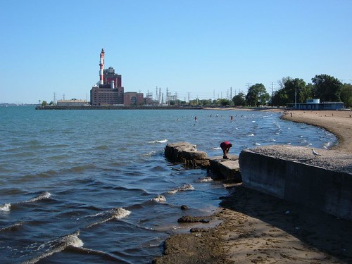
Once you finally get past US Steel, the lakeshore of Gary is quite lovely, marking the beginning of the Indiana Dunes lakeshore park. Due to some Machiavellian bargaining back in the 1950s, part of the dunes was carved away to provide room for still more industry, another steel mill (likewise inaccessible) and a power plant at Michigan City that looms over some of the beaches.

It can be a shock to look back from east Gary's waterfront and suddenly realize how far you've come from Chicago, whose skyline is 30 miles distant and barely visible across the lake. And it's a bigger shock to realize the amount of industry you've passed along the way.